A significant dust episode originating from Africa is expected to affect Cyprus in the coming days, as unstable weather conditions continue across the region.
The warm front of a low-pressure system that moved from Africa towards Greece, bringing heavy rainfall overnight, has now shifted further north, leading to a gradual improvement in weather conditions. This system is expected to merge with a broader and deeper low-pressure system over the central Mediterranean.
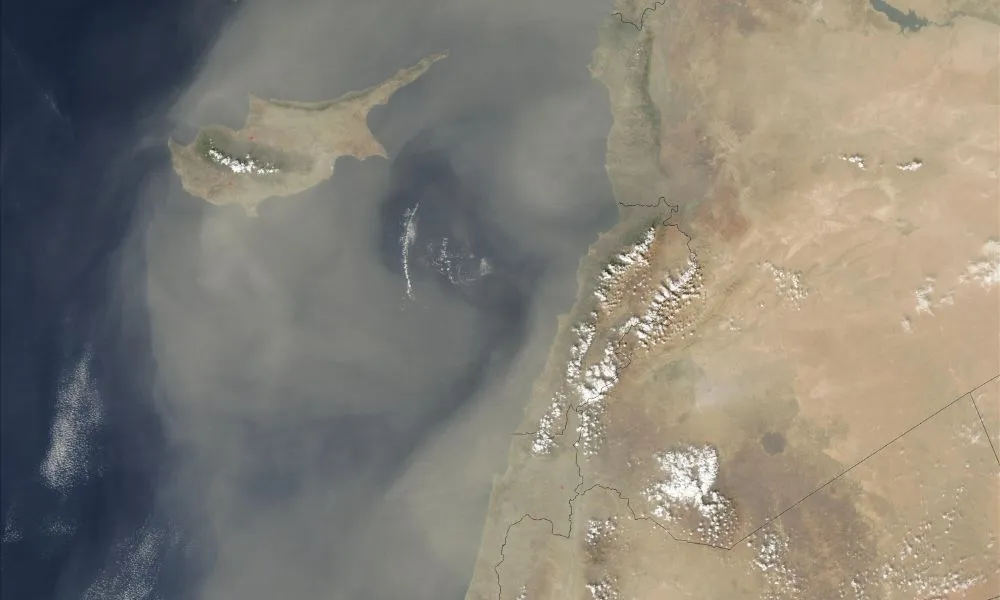
At the same time, large quantities of dust lifted from Africa, which heavily affected Crete, are moving towards Cyprus. Although concentrations are expected to ease compared to earlier peaks, elevated dust levels are forecast to impact the island in the coming hours and continue through the end of the week, with fluctuations in intensity. Localised weather phenomena are also expected, mainly during midday and afternoon hours, while temperatures will remain close to seasonal averages.
Thursday weather outlook
On Thursday, the low-pressure system that affected the island overnight has moved towards northern Greece and is merging with a deeper system over the central Mediterranean.
The day began with generally cloudy conditions and local showers, including muddy rain due to dust. Conditions are expected to gradually improve, with intervals of sunshine developing later in the day. However, dense dust currently located west of the island is moving eastwards and will progressively affect all areas, resulting in hazy skies even during sunny periods.
Temperatures are expected to remain stable, reaching around 20 to 22 degrees Celsius inland and along the coasts, and around 11 degrees in the Troodos mountains.
Friday forecast
By Friday, the low-pressure system will weaken over Greece.
Weather conditions in Cyprus will initially be mostly clear with some local cloud. During the afternoon, increased cloud cover is expected to develop, particularly over mountainous, inland and eastern areas, bringing isolated showers and possibly a thunderstorm, especially in the northeast. Some localised showers may also occur in western and southwestern areas.
Dust levels will remain elevated and are expected to increase further during the second half of the day. Temperatures will remain close to seasonal averages, with a slight drop in mountainous areas.
Saturday conditions
On Saturday, a weak trough in the mid-atmosphere will begin to affect the region.
The day will start mostly clear with some local cloud, but increased cloud cover is expected to develop later, particularly over mountainous, inland and southeastern areas. Isolated showers are likely, mainly along the southeastern slopes of the Troodos range and in eastern to southeastern parts of the island. Dust will remain present in the atmosphere, though concentrations are expected to gradually decrease later in the day.
During the evening, partly cloudy conditions are expected in most areas, with localised showers possible in the southwest.
Temperatures will remain near seasonal norms, reaching around 20 to 22 degrees inland and along the coasts, and around 8 degrees in the mountains.
Sunday outlook
On Sunday, a weak low-pressure system at the surface combined with a mid-level trough will continue to affect the region.
Conditions will initially be partly cloudy, with localised showers possible in southwestern areas. By midday and afternoon, increased cloud cover is expected to develop over mountainous, inland and eastern to southeastern areas, bringing local showers and isolated thunderstorms.
Dust will remain in the atmosphere at lower concentrations. Temperatures will remain stable, ranging between 19 and 22 degrees inland and along the coasts, and around 6 degrees in the Troodos mountains.
Source: kitasweather.com