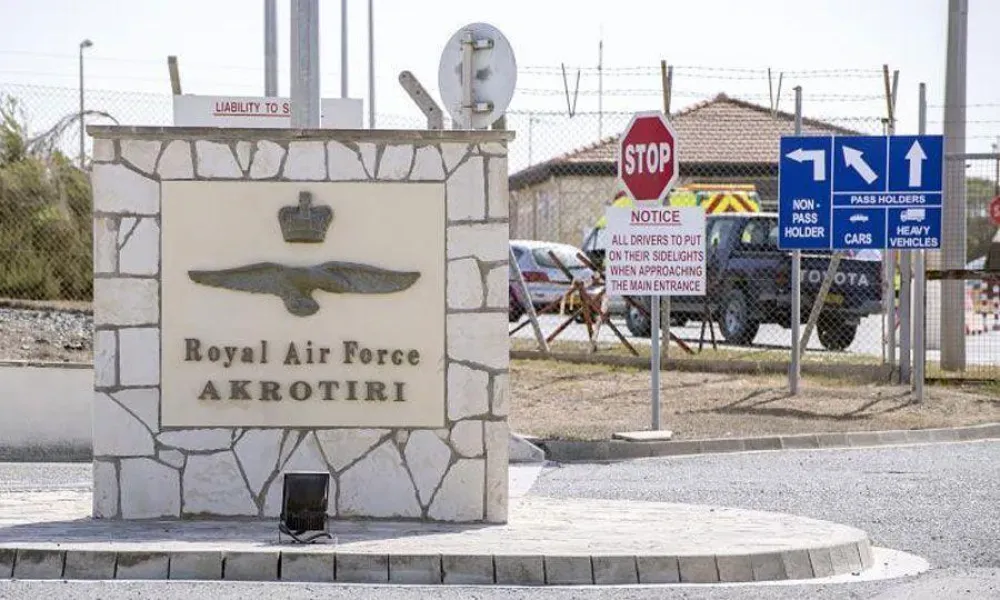
A drone attack targeting the British Royal Air Force base at Akrotiri in Cyprus may have relied on publicly accessible satellite imagery, according to a report by The Times. The newspaper states that Hezbollah is believed to have launched the drone earlier this month toward reconnaissance aircraft stationed at the base. The aircraft were reportedly visible through publicly available images on Google Maps.
Drone reportedly guided using public satellite imagery
According to The Times, attackers used Google Maps to help guide a drone toward the British military base in Akrotiri. The drone is believed to have been launched from Lebanon and aimed at aircraft located at the Royal Air Force installation in Cyprus. Publicly available satellite images reportedly show two American U-2 reconnaissance aircraft parked outside the hangar that was struck during the incident.
A military source quoted by the newspaper said the attack was concerning because the drone appeared to strike the intended target. However, the source suggested it was unlikely to have involved sophisticated intelligence gathering. Instead, the source said the incident suggested the attackers relied on widely available tools such as GPS and Google Maps.
Questions raised about visibility of the base online
The report notes that technology companies can blur or obscure sensitive locations on mapping platforms when requested by governments. In some cases, Israeli and American air bases in the region appear on Google Maps at reduced resolution or with aircraft deliberately blurred for security reasons.
Even civilian infrastructure, such as Heathrow Airport in the United Kingdom, has aircraft removed from satellite images, although this is done primarily to improve map clarity rather than for security purposes. The Times said it contacted the British Ministry of Defence about the satellite imagery and asked whether efforts were under way to obscure parts of the Akrotiri base from public view.
By Monday morning, the aircraft were still visible on the platform, while the ministry declined to comment on whether any steps were being taken to remove them.
Reconnaissance aircraft presence described as widely known
Justin Crump, chief executive of the intelligence consultancy Sibylline and a former British Army officer, told the newspaper that the presence of U-2 reconnaissance aircraft at the base is widely known. He described the situation as “the worst kept secret in the Mediterranean”, adding that the availability of detailed imagery online made it easier than it should have been to target the installation with precision.
Crump noted that the use of mapping platforms by hostile actors is not a new development, recalling that insurgents in Iraq in 2004 had also used Google Maps imagery to identify and target positions within military camps.
Navigation system reportedly identified in the drone
According to the report, the drone contained a Russian-made Kometa-B navigation system. Similar equipment has previously been identified in devices intercepted by Ukrainian air defences in December. The head of the British armed forces, Sir Richard Knighton, confirmed on Saturday that the attack on the RAF base in Cyprus was launched from Lebanon by a group supported by Iran. Hezbollah is believed to have carried out the operation.
Knighton added that growing cooperation between Iran and Russia has increased the capabilities of allied forces and presents a more complex security challenge.
Source: iefimerida.gr / The Times